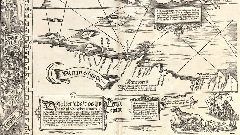
Carta Marina Universalis Fries 1525 1530 Sheet 05
1525
About this artwork
This is a woodcut map section from Lorenz Fries's Carta Marina, depicting parts of the New World, including Hispaniola and portions of the South American coastline. It incorporates cartographic text and annotations in German characteristic of 16th-century map-making.
Did you know?
This map is a significant example of 16th-century European cartography, reflecting the era's initial and often distorted understanding of the Americas. The inclusion of illustrations, such as the depiction of 'cannibals' in the bottom right corner, reveals the subjective and sometimes sensationalized perspective Europeans held toward indigenous populations at the time. The text blocks specifically attempt to categorize and interpret the new geography and cultures encountered during the Age of Discovery.

Know the artwork. Knowing its title and artist turns a beautiful image into a story worth sharing — with a museum label:
Carta Marina Universalis Fries 1525 1530 Sheet 05
Lorenz Fries, 1525
On your wall. Unlock the 4K download and keep this piece in your Vault — forever.