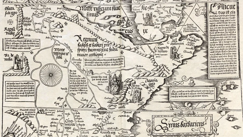
Carta Marina Universalis Fries 1525 1530 Sheet 07
1525
About this artwork
This is an early 16th-century woodcut map depicting parts of Africa and the Red Sea. It is part of the larger Carta Marina Universalis series created by Lorenz Fries.
Did you know?
This map is a significant example of early 16th-century geography, blending traditional Ptolemaic knowledge with the emerging discoveries of the Age of Exploration. The map incorporates mythological figures and text descriptions that reflect the European worldview of the African continent during the Renaissance period.
Know the artwork. Knowing its title and artist turns a beautiful image into a story worth sharing — with a museum label:
Carta Marina Universalis Fries 1525 1530 Sheet 07
Lorenz Fries, 1525
On your wall. Unlock the 4K download and keep this piece in your Vault — forever.