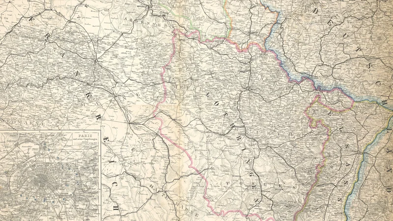
Justus Perthes' Specialkarte von der deutschen Grenze bis Paris
1870
About this artwork
This is a detailed 19th-century map published by Justus Perthes, covering the region from the German border to Paris, including a small inset plan of Paris and its surroundings. It was edited by August Petermann and printed by Carl Hellfarth in Gotha.
Did you know?
Published in 1870, this map was highly strategic during the outbreak of the Franco-Prussian War, as it provided essential geographical data for the movement of troops towards Paris. August Petermann, a renowned German cartographer, produced many such maps that were instrumental for military planning and general public interest during this pivotal conflict in European history.

On your wall. Unlock the 4K download and keep this piece in your Vault — forever.
Know the artwork. Knowing its title and artist turns a beautiful image into a story worth sharing — with a museum label:
Justus Perthes' Specialkarte von der deutschen Grenze bis Paris
August Petermann, 1870