Map of Europe
1804 Rijksmuseum
About this artwork
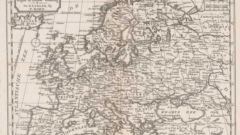
An 18th-century style engraved map of the European continent published by F. Bohn in Haarlem. It details political boundaries and geographical features of the era.
Did you know?
Published in Haarlem by F. Bohn, this map offers a snapshot of European geography at the dawn of the Napoleonic era. Such maps were essential tools for both administrative control and the growing public interest in global geopolitics during the early 19th century.

On your wall. Unlock the HD download and keep this piece in your Vault — forever.
Know the artwork. Knowing its title and artist turns a beautiful image into a story worth sharing — with a museum label:
Map of Europe
Bohn, 1804