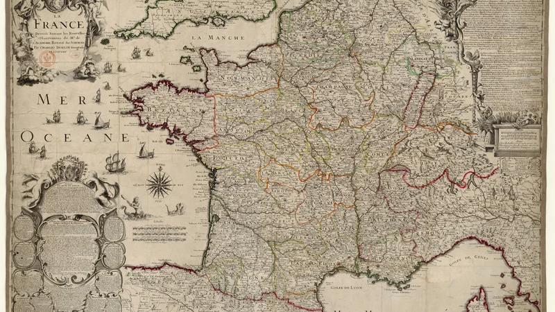
La France dressée suivant les nouvelles observations de l'Académie royale des Sciences
1713
About this artwork
This is a detailed copperplate engraving of a map of France, created by Charles Inselin based on observations by the Académie Royale des Sciences. It features elaborate cartouches, maritime illustrations, and an ornate compass rose typical of 18th-century cartography.
Did you know?
This map reflects a pivotal era in the French Enlightenment, specifically highlighting the influence of the Académie Royale des Sciences. Its publication served both as a navigational tool and as a display of state authority, showcasing the 'new observations' that corrected previous inaccurate representations of French geography. These maps were often commissioned not just for geography enthusiasts, but for the royal administration to better govern the growing nation.

On your wall. Unlock the 4K download and keep this piece in your Vault — forever.
Know the artwork. Knowing its title and artist turns a beautiful image into a story worth sharing — with a museum label:
La France dressée suivant les nouvelles observations de l'Académie royale des Sciences
Charles Inselin, 1713