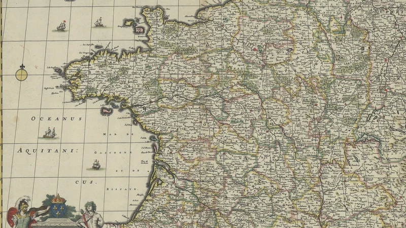
Accuratissima Galliæ tabula vulgo Royaume de France
1690
About this artwork
An intricately engraved 17th-century map of the Kingdom of France by Dutch cartographer Frederik de Wit. The piece features a decorative cartouche in the lower-left corner depicting allegorical figures alongside the French royal crest.
Did you know?
Frederik de Wit was one of the most prolific mapmakers of the Dutch Golden Age, operating a successful printing house in Amsterdam. This map exemplifies the era's obsession with precise geographic knowledge, serving both as a practical navigational aid and a display of national pride through its elaborate, royal-themed cartouche.

On your wall. Unlock the 4K download and keep this piece in your Vault — forever.
Know the artwork. Knowing its title and artist turns a beautiful image into a story worth sharing — with a museum label:
Accuratissima Galliæ tabula vulgo Royaume de France
Frederik de Wit, 1690