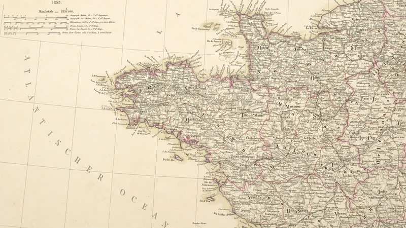
France in IV Sheets: Northwestern France
1858
About this artwork
This is a detailed 19th-century map of northwestern France, specifically part of a four-sheet series by Friedrich von Stülpnagel and engraved by C. Poppey. It was published in Gotha by the renowned cartographic firm Justus Perthes.
Did you know?
The Justus Perthes publishing house, located in Gotha, Germany, was one of the most influential cartographic centers in the world during the 19th century. Friedrich von Stülpnagel's series on France was highly prized for its extreme accuracy and level of topographical detail, serving as a primary reference for scholars and travelers of the era.

On your wall. Unlock the 4K download and keep this piece in your Vault — forever.
Know the artwork. Knowing its title and artist turns a beautiful image into a story worth sharing — with a museum label:
France in IV Sheets: Northwestern France
Friedrich von Stülpnagel, 1858