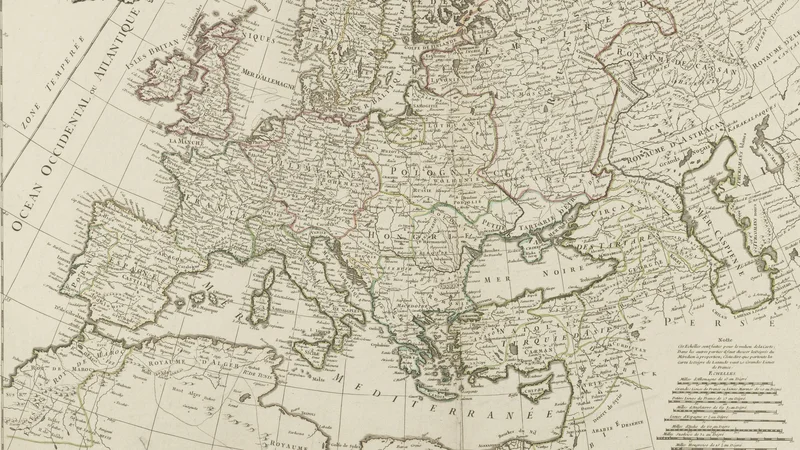
Europe According to the New Observations of Mr. de Cassini and Mr. Hass
1747
About this artwork
An 18th-century copperplate engraved map of Europe based on contemporary geographical data from Cassini and Hass, produced by the French royal geographer Georges-Louis Le Rouge.
Did you know?
Georges-Louis Le Rouge was a highly prolific mapmaker and engineer for the French king, known for his extensive atlas production that brought the latest scientific geographic discoveries to the public. This map relies on the pioneering work of the Cassini family, who were instrumental in creating the first modern topographical map of France using triangulation techniques. The work stands as a testament to the Age of Enlightenment's obsession with quantifying and accurately representing the physical world through empirical observation.

On your wall. Unlock the 4K download and keep this piece in your Vault — forever.
Know the artwork. Knowing its title and artist turns a beautiful image into a story worth sharing — with a museum label:
Europe According to the New Observations of Mr. de Cassini and Mr. Hass
Georges-Louis Le Rouge, 1747