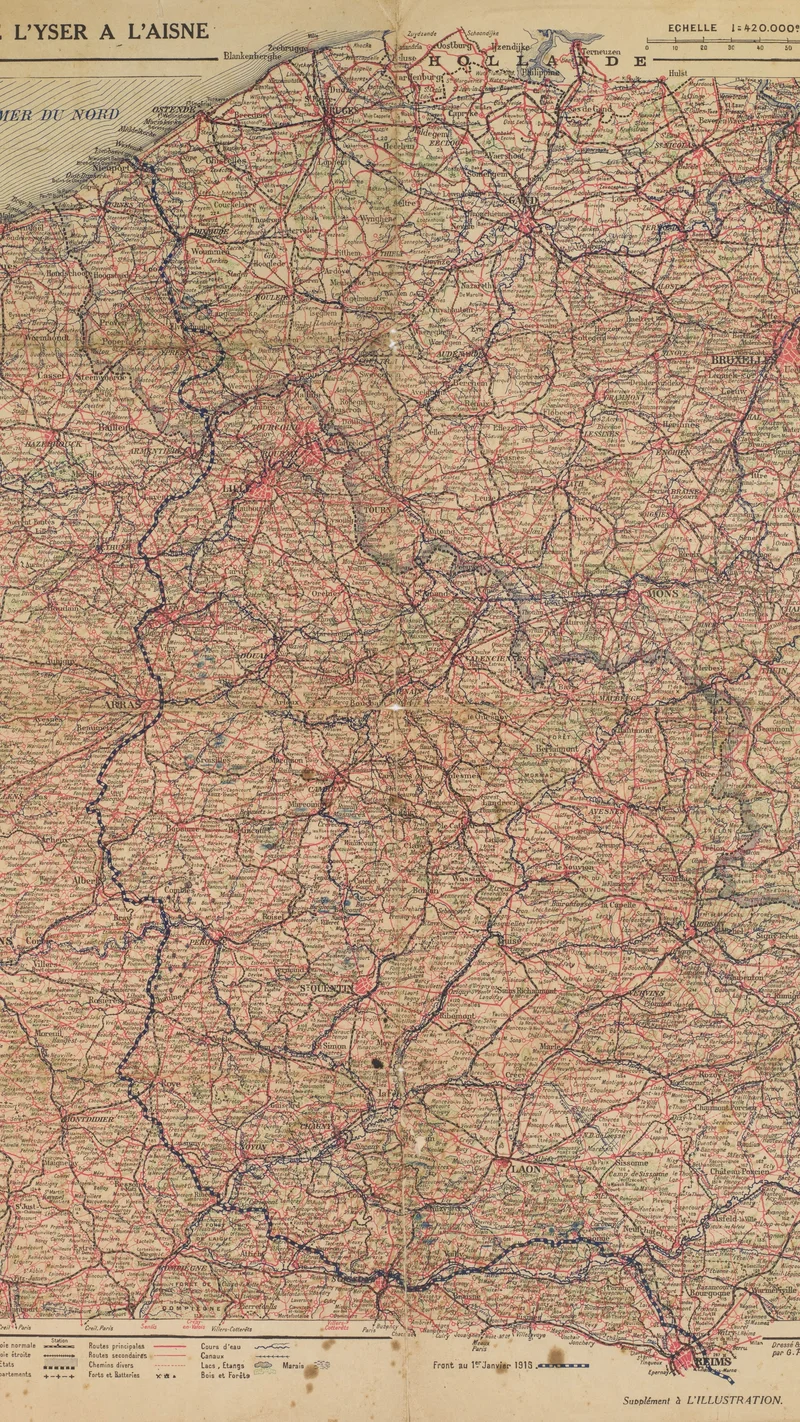
De L'Yser à L'Aisne
1916 João Baptista de Campos Aguirra Collection
About this artwork
This is a detailed topographical map printed as a supplement to the French magazine L'Illustration, documenting the front lines of World War I in January 1916. The map highlights the border regions between France and Belgium, spanning from the North Sea coast to the Aisne river.
Did you know?
Published as a supplement to the famous French weekly L'Illustration, this map served to keep the home front informed about the grim reality of the 'Great War' as it unfolded. At the time, such visual aids were the primary way for the public to comprehend the shifting, static front lines of the trenches that defined the conflict. It acts as a somber artifact of a period where geography became a matter of life and death on a massive, mechanical scale.

On your wall. Unlock the 4K download and keep this piece in your Vault — forever.
Know the artwork. Knowing its title and artist turns a beautiful image into a story worth sharing — with a museum label:
De L'Yser à L'Aisne
Georges Peltier, 1916