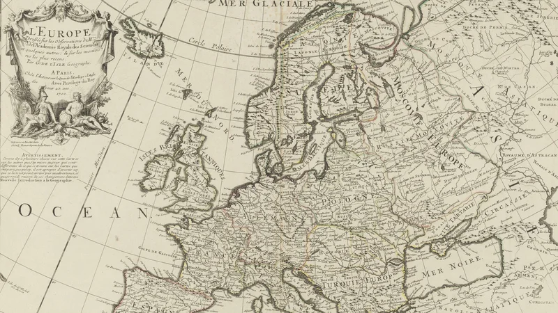
L'Europe: dressée sur les observations de M.rs de l'Academie royale des sciences
1700 Bibliothèque nationale de France
About this artwork
An 18th-century copperplate engraved map of Europe, featuring an ornate cartouche designed by Charles-Louis Simonneau and cartography by Guillaume Delisle. The map reflects the geographical knowledge of the French Royal Academy of Sciences at the turn of the century.
Did you know?
Guillaume Delisle was a revolutionary figure in cartography, known for correcting the geographical errors of his predecessors, such as those made by Sanson. By relying on recent observations from the Académie Royale des Sciences, he helped shift map-making from speculative guesswork to a more rigorous, scientific endeavor. The elaborate cartouche in the top left corner highlights the status of the map, illustrating the connection between royal patronage and the advancement of enlightenment science.
On your wall. Unlock the 4K download and keep this piece in your Vault — forever.
Know the artwork. Knowing its title and artist turns a beautiful image into a story worth sharing — with a museum label:
L'Europe: dressée sur les observations de M.rs de l'Academie royale des sciences
Guillaume Delisle, 1700