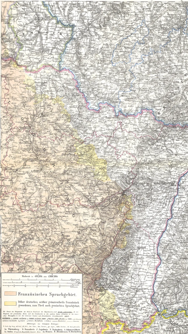
Die Deutsch-Französischen Grenzländer
1870
About this artwork
This is a detailed historical cartographic map focusing on the border regions between Germany and France. It highlights linguistic demographics and political boundaries during the period of the Franco-Prussian War.
Did you know?
Published in 1870, this map served a significant political purpose during the outbreak of the Franco-Prussian War. By color-coding regions based on the 'French-speaking area' versus 'formerly German, now mostly French-speaking' areas, it provided a visual justification for the annexation of Alsace-Lorraine into the newly forming German Empire.

On your wall. Unlock the 4K download and keep this piece in your Vault — forever.
Know the artwork. Knowing its title and artist turns a beautiful image into a story worth sharing — with a museum label:
Die Deutsch-Französischen Grenzländer
Heinrich Kiepert, 1870