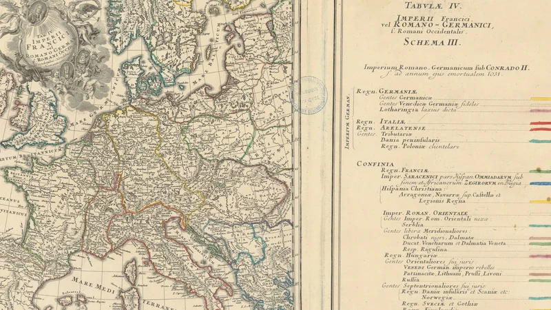
Tabula IV: Imperii Francici vel Romano-Germanici, Schema III
1750
About this artwork
An 18th-century cartographic engraving depicting the Holy Roman Empire during the reign of Conrad II, with a comprehensive key explaining regional political affiliations. The map includes geographic details of Europe and specific color-coded borders to delineate territory.
Did you know?
This map is a prime example of the scientific rigor employed by the Homann heirs, a famous Nuremberg cartographic publishing house. By color-coding the map according to the political climate of 1031, they transformed static geography into a dynamic historical narrative, allowing 18th-century readers to visualize the complex web of vassalage and regional autonomy within the medieval Holy Roman Empire.

On your wall. Unlock the 4K download and keep this piece in your Vault — forever.
Know the artwork. Knowing its title and artist turns a beautiful image into a story worth sharing — with a museum label:
Tabula IV: Imperii Francici vel Romano-Germanici, Schema III
Héritiers de Homann, 1750