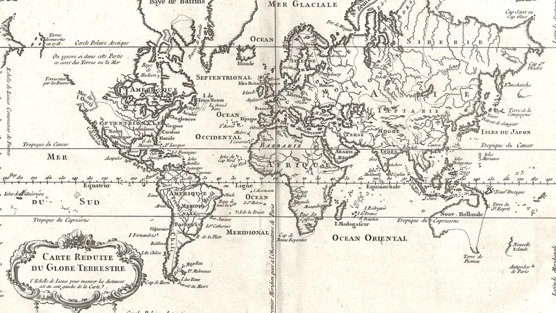
Carte Reduite du Globe Terrestre
1764
About this artwork
An 18th-century nautical world map by Jacques-Nicolas Bellin, designed as a reduced chart for calculating distances. It features a focus on French maritime geography and is characterized by a central meridional line.
Did you know?
Jacques-Nicolas Bellin was a preeminent French hydrographer and the first Ingénieur de la Marine of the French Hydrographic Office. His maps were highly valued for their accuracy and served as the standard for French naval navigation throughout the 18th century, playing a crucial role in the expansion of maritime knowledge during the Age of Enlightenment.

On your wall. Unlock the 4K download and keep this piece in your Vault — forever.
Know the artwork. Knowing its title and artist turns a beautiful image into a story worth sharing — with a museum label:
Carte Reduite du Globe Terrestre
Jacques-Nicolas Bellin, 1764