Galliae regni potentiss. nova descriptio
1570
About this artwork
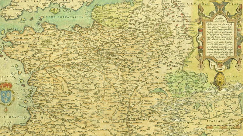
This is a hand-colored engraved map of France, titled 'Galliae regni potentiss. nova descriptio', created by the cartographer Jean Jolivet. It features detailed topographical markings, a royal coat of arms, and a decorative cartouche.
Did you know?
Jean Jolivet was a pioneering French cartographer whose work, commissioned by King Henry II, significantly improved the geographical accuracy of French maps in the 16th century. This map is notable for its artistic flair, including a prominent lion's head motif and the sophisticated heraldic details of the French monarchy, reflecting both the scientific rigor and the national pride of the Renaissance era.

On your wall. Unlock the 4K download and keep this piece in your Vault — forever.
Know the artwork. Knowing its title and artist turns a beautiful image into a story worth sharing — with a museum label:
Galliae regni potentiss. nova descriptio
Jean Jolivet, 1570