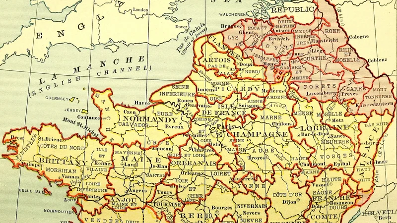
Map of France: The French Departments Under the First Empire
1909
About this artwork
A color-coded historical map illustrating the administrative division of France into departments during the First French Empire, published as part of Jules Michelet's Histoire de France.
Did you know?
This map features the 'Batavian Republic,' a short-lived client state of revolutionary France that existed between 1795 and 1806. The administrative borders shown reflect the territorial expansion of the Napoleonic era, which dramatically reshaped the map of Europe. The inclusion of this map in a 1909 edition of Michelet’s work serves to visualize the complex geopolitical shifts that defined 19th-century French history.

On your wall. Unlock the HD download and keep this piece in your Vault — forever.
Know the artwork. Knowing its title and artist turns a beautiful image into a story worth sharing — with a museum label:
Map of France: The French Departments Under the First Empire
Jules Michelet, 1909