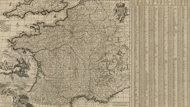
Galliae seu Franciae tabula qua omnes provinciae, viae angiariae et aliae res notatu dignae
1660 Bibliothèque nationale de France
About this artwork
An engraved map of France produced by Nicolaas Visscher I in 1660, featuring extensive marginal lists of geographical data and decorative cartographic elements.
Did you know?
This detailed map reflects the high standards of the Dutch Golden Age of cartography, for which the Visscher family was famous. Beyond mere geography, these maps often included extensive lists of towns and regions, making them essential tools for travelers, diplomats, and merchants of the 17th century.

On your wall. Unlock the 4K download and keep this piece in your Vault — forever.
Know the artwork. Knowing its title and artist turns a beautiful image into a story worth sharing — with a museum label:
Galliae seu Franciae tabula qua omnes provinciae, viae angiariae et aliae res notatu dignae
Nicolaas Visscher, 1660