Comic Map of Europe in 1870
1870 Rijksmuseum
About this artwork
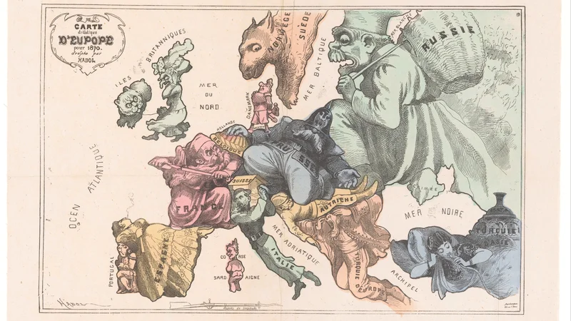
This is a hand-colored satirical lithograph depicting European nations as caricatured figures, reflecting the geopolitical tensions on the eve of the Franco-Prussian War.
Did you know?
This map, created by Paul Hadol in 1870, is a quintessential example of 'serio-comic' cartography that gained popularity in the 19th century. By portraying countries as human figures, Hadol highlighted the specific political anxieties of the era, such as the aggressive expansionism of Prussia and the looming threat of the Russian Empire. It served as a widely circulated form of visual propaganda that allowed the public to visualize complex international relations through simplified, often xenophobic, archetypes.

On your wall. Unlock the 4K download and keep this piece in your Vault — forever.
Know the artwork. Knowing its title and artist turns a beautiful image into a story worth sharing — with a museum label:
Comic Map of Europe in 1870
Paul Hadol, 1870