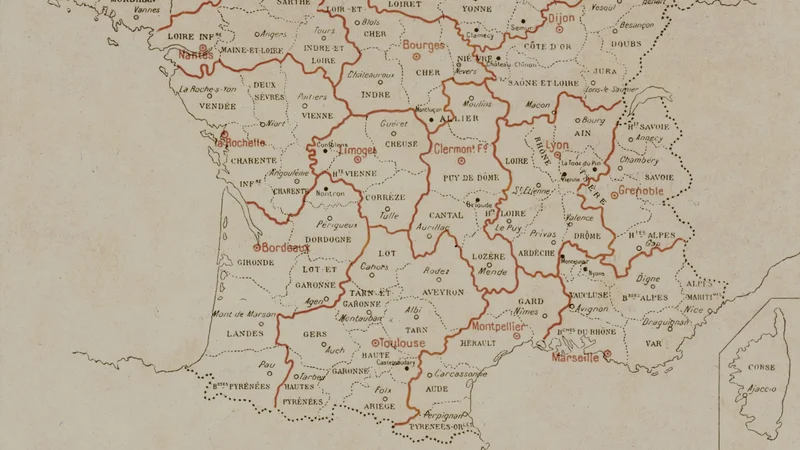
Map of France by Regions, Vidal-Lablache
0
1910
About this artwork
A detailed educational map of French administrative regions and departments, printed in the early 20th century.
Did you know?
Paul Vidal de La Blache was a pioneer of human geography and his maps became staples in French schools for decades. These wall maps were so ubiquitous in classrooms that they became a cornerstone of French childhood memory and national identity.

On your wall. Unlock the HD download and keep this piece in your Vault — forever.
Know the artwork. Knowing its title and artist turns a beautiful image into a story worth sharing — with a museum label:
Map of France by Regions, Vidal-Lablache
Paul Vidal de La Blache, 1910