Battlefield of Saint-Aubin-du-Cormier (1488)
1880s The British Library
About this artwork
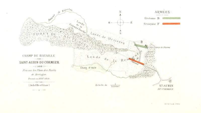
A historical military map showing the positioning of Breton and French armies at the Battle of Saint-Aubin-du-Cormier. The map is based on 18th-century forest plans and includes a compass rose and a scale of 1:50,000.
Did you know?
The Battle of Saint-Aubin-du-Cormier was a pivotal engagement in the 'Mad War' (la Guerre folle) between the Duchy of Brittany and the Kingdom of France. The French victory effectively marked the beginning of the end for Breton independence, ultimately leading to the marriage of Anne of Brittany to Charles VIII and the eventual annexation of the duchy by France.

On your wall. Unlock the HD download and keep this piece in your Vault — forever.
Know the artwork. Knowing its title and artist turns a beautiful image into a story worth sharing — with a museum label:
Battlefield of Saint-Aubin-du-Cormier (1488)
The British Library, 1880s