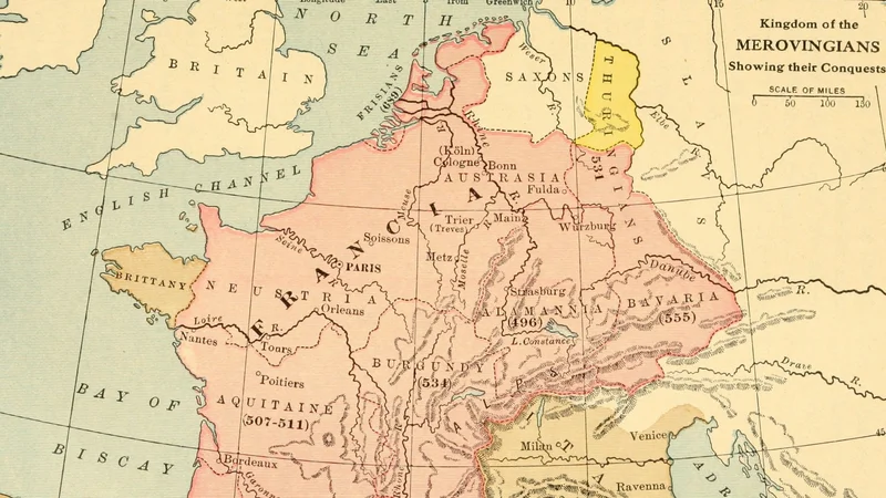
The Kingdom of the Merovingians: Showing their Conquests
1913
About this artwork
A historical map illustration showing the territorial expansion of the Merovingian Kingdom, likely sourced from a 1913 educational text.
Did you know?
This map comes from an early 20th-century educational series designed to teach students about the rise of the Merovingian dynasty, which unified the Frankish tribes. The Merovingians, often called the 'long-haired kings,' established the foundations for what would eventually become the Kingdom of France. By charting these specific conquests, the map visually records the transition of Europe from the late Roman administration to the localized power structures of the early Middle Ages.


On your wall. Unlock the HD download and keep this piece in your Vault — forever.
Know the artwork. Knowing its title and artist turns a beautiful image into a story worth sharing — with a museum label:
The Kingdom of the Merovingians: Showing their Conquests
Willis West, 1913