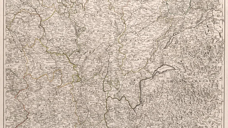
Neueste Generalkarte von Frankreich, central eastern sheet
1790
About this artwork
An 18th-century engraved map showing central-eastern France, parts of Switzerland, and Savoy, with detailed topography and geopolitical boundaries of the era.
Did you know?
Franz Anton Schraembl was a prominent Austrian mapmaker who specialized in grand, multi-sheet wall maps during the late 18th century. His works were highly regarded for their immense scale and meticulous detail, often serving as critical tools for contemporary political and military planning in Europe. This map captures a pivotal moment just before the major border revisions caused by the French Revolutionary Wars.

On your wall. Unlock the 4K download and keep this piece in your Vault — forever.
Know the artwork. Knowing its title and artist turns a beautiful image into a story worth sharing — with a museum label:
Neueste Generalkarte von Frankreich, central eastern sheet
Franz Anton Schraembl, 1790