Neueste Generalkarte von Frankreich, central western sheet
1790
About this artwork
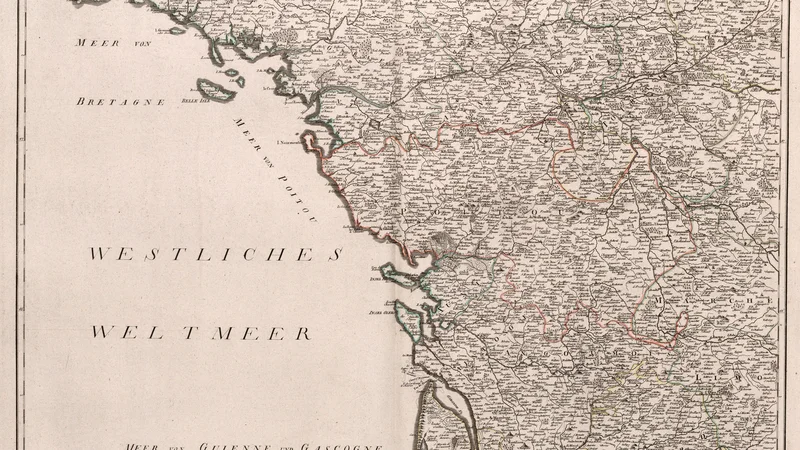
This is a detailed historical map sheet showing central-western France, including coastal regions like Brittany and Poitou, published by Franz Anton Schraembl. The map employs traditional 18th-century cartographic conventions, utilizing copperplate engraving techniques to render borders, settlements, and geographical features.
Did you know?
Franz Anton Schraembl was a prominent Austrian map publisher who produced this extensive map of France during a time of great political transformation. These series of maps provided Europeans with a highly accurate overview of French geography just prior to the Napoleonic era's drastic redrawing of borders.

On your wall. Unlock the 4K download and keep this piece in your Vault — forever.
Know the artwork. Knowing its title and artist turns a beautiful image into a story worth sharing — with a museum label:
Neueste Generalkarte von Frankreich, central western sheet
Franz Anton Schraembl, 1790