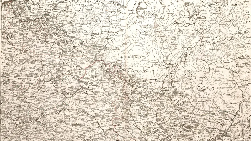
Neueste Generalkarte von Frankreich, northeastern sheet
1790
About this artwork
This is a detailed historical cartographic engraving representing the northeastern region of France as part of a larger general map. It displays political boundaries, topography, and settlements characteristic of late 18th-century European mapmaking.
Did you know?
Franz Anton Schraembl was a prominent Austrian mapmaker and publisher in Vienna who dedicated himself to disseminating geographical knowledge. His maps were highly valued during the late 18th century for their precision and clarity, serving as essential reference tools for travelers, diplomats, and scholars navigating the complex political landscape of post-Enlightenment Europe.
On your wall. Unlock the 4K download and keep this piece in your Vault — forever.
Know the artwork. Knowing its title and artist turns a beautiful image into a story worth sharing — with a museum label:
Neueste Generalkarte von Frankreich, northeastern sheet
Franz Anton Schraembl, 1790