Neueste Generalkarte von Frankreich, northwestern sheet
1790
About this artwork
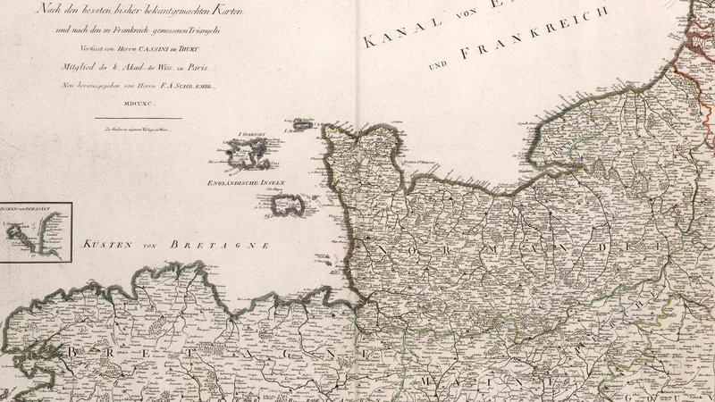
This is an 18th-century engraved map of northwestern France, specifically covering the Normandy and Brittany regions, published by Franz Anton Schraembl in Vienna. It is based on the surveys of Cassini de Thury, a prominent French cartographer of the era.
Did you know?
This map is part of a larger project by Franz Anton Schraembl to bring the high-quality French cartography of the Cassini family to a wider German-speaking audience. The Cassini maps were revolutionary for their time, being the first to be based on a national geodetic triangulation survey, which drastically improved the accuracy of mapmaking in the 18th century.

On your wall. Unlock the 4K download and keep this piece in your Vault — forever.
Know the artwork. Knowing its title and artist turns a beautiful image into a story worth sharing — with a museum label:
Neueste Generalkarte von Frankreich, northwestern sheet
Franz Anton Schraembl, 1790