Neueste Generalkarte von Frankreich, southeastern sheet
1790
About this artwork
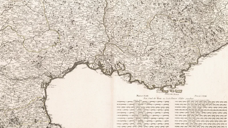
This is an 18th-century engraved map of southeastern France, showing administrative regions and geographical features like coastlines and mountain ranges. It includes a detailed scale table in the lower right corner with various units of measurement.
Did you know?
Franz Anton Schraembl was a prominent Austrian cartographer and publisher based in Vienna. This map was part of a larger project to create a comprehensive atlas of France, which served as a vital tool for navigation and military planning in an era before satellite imagery.

On your wall. Unlock the 4K download and keep this piece in your Vault — forever.
Know the artwork. Knowing its title and artist turns a beautiful image into a story worth sharing — with a museum label:
Neueste Generalkarte von Frankreich, southeastern sheet
Franz Anton Schraembl, 1790