Essay d'une carte réduite contenant les parties connues du globe terrestre
1746
About this artwork
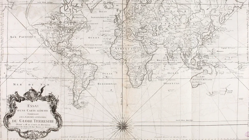
An 18th-century French world map included as a plate in the 'Histoire générale des voyages'. It features decorative cartouches and reflects the geographical knowledge of the mid-1700s.
Did you know?
This map was published during the Enlightenment, a period when European powers were aggressively documenting 'known' parts of the world to facilitate trade and colonial expansion. Interestingly, the label 'Nouvelle Hollande' (New Holland) is used for Australia, a name given by Dutch explorers long before the British claim that popularized the name Australia. It serves as a visual record of how Europeans viewed the global power structure and geography in the mid-18th century.

On your wall. Unlock the 4K download and keep this piece in your Vault — forever.
Know the artwork. Knowing its title and artist turns a beautiful image into a story worth sharing — with a museum label:
Essay d'une carte réduite contenant les parties connues du globe terrestre
Internet Archive Book Images, 1746