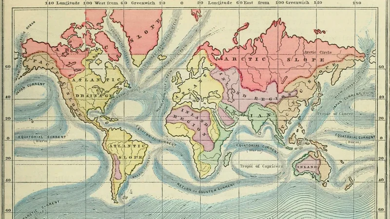
Monteith's physical and political geography world map
1875 Internet Archive
About this artwork
A 19th-century educational world map depicting physical drainage basins and oceanic currents. This plate originates from Monteith's physical and political geography textbook.
Did you know?
This map illustrates the 19th-century approach to geography, which emphasized the interconnectedness of physical features like river basins and ocean currents. It was designed for a standard American school curriculum to teach students how the natural landscape dictated political and economic development.

On your wall. Unlock the HD download and keep this piece in your Vault — forever.
Know the artwork. Knowing its title and artist turns a beautiful image into a story worth sharing — with a museum label:
Monteith's physical and political geography world map
Internet Archive Book Images, 1875