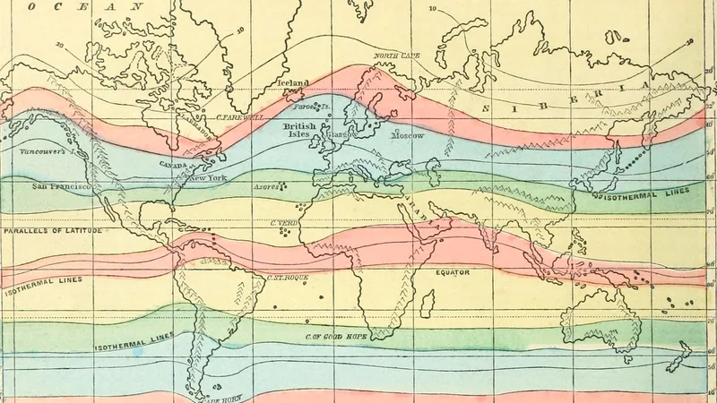
World Map of Isothermal Lines
1875
About this artwork
An educational world map plate detailing isothermal lines and degrees of latitude, likely sourced from a 19th-century geography textbook. The print features color-coded climatic zones across global landmasses.
Did you know?
This map illustrates the Victorian-era approach to 'Geography taught as a science,' focusing on the relationship between temperature and latitude. These types of isothermal maps were critical in the 19th century for understanding global climate patterns, influencing everything from agricultural planning to early meteorology. It serves as a visual record of how scientific knowledge was disseminated to students during the late 1800s.

On your wall. Unlock the HD download and keep this piece in your Vault — forever.
Know the artwork. Knowing its title and artist turns a beautiful image into a story worth sharing — with a museum label:
World Map of Isothermal Lines
Internet Archive Book Images, 1875