Physical and commercial geography map
1910
About this artwork
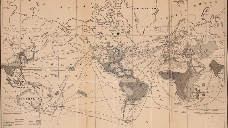
This is a detailed world map from the 1910 publication 'Physical and Commercial Geography', illustrating global trade routes alongside the geographic distribution of diseases like malaria, dysentery, and yellow fever.
Did you know?
This map provides a fascinating snapshot of how early 20th-century geographers viewed the intersection of global trade networks and public health. By layering shipping routes over areas prone to specific diseases, the publication aimed to educate merchants and travelers on the physical realities that influenced international commerce at the time.

On your wall. Unlock the HD download and keep this piece in your Vault — forever.
Know the artwork. Knowing its title and artist turns a beautiful image into a story worth sharing — with a museum label:
Physical and commercial geography map
Internet Archive Book Images, 1910