Historical Map of Medieval France and Surrounding Territories
1900
About this artwork
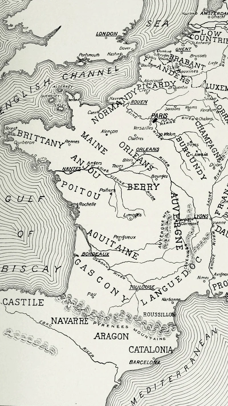
A detailed black and white historical map depicting the territorial divisions of France and neighboring regions during the medieval period. It features labels for major provinces, rivers, and surrounding seas as part of a historical atlas publication.
Did you know?
This map was published as part of a massive historical series intended to provide a comprehensive view of global history for the general public at the turn of the 20th century. Such illustrations were essential for Victorian-era readers to visualize the complex and shifting political boundaries of Europe before the dawn of modern digital cartography. The map showcases how provinces like Normandy, Aquitaine, and Burgundy were once distinct entities under the broader French influence.

On your wall. Unlock the HD download and keep this piece in your Vault — forever.
Know the artwork. Knowing its title and artist turns a beautiful image into a story worth sharing — with a museum label:
Historical Map of Medieval France and Surrounding Territories
Internet Archive Book Images, 1900