Paris and Environs: Hand-book for Travellers (Map Extract)
1881
About this artwork
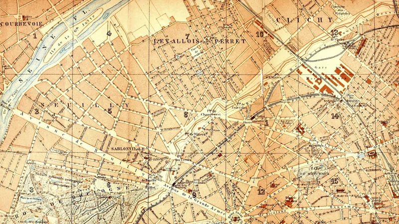
This is a detailed topographical map extract showing the northwestern districts of Paris, including Levallois-Perret, Clichy, and Neuilly-sur-Seine. It was originally published as part of a Baedeker travel guide for visitors to the French capital.
Did you know?
Karl Baedeker's travel guides were the gold standard for Victorian tourists, earning the term 'Baedekering' for the act of following his meticulously researched routes. These guides were so influential that they were considered essential companions for any gentleman or lady embarking on a Grand Tour through Europe, providing not just maps, but reliable tips on hotels, sights, and local customs.

On your wall. Unlock the HD download and keep this piece in your Vault — forever.
Know the artwork. Knowing its title and artist turns a beautiful image into a story worth sharing — with a museum label:
Paris and Environs: Hand-book for Travellers (Map Extract)
Karl Baedeker (Firm), 1881