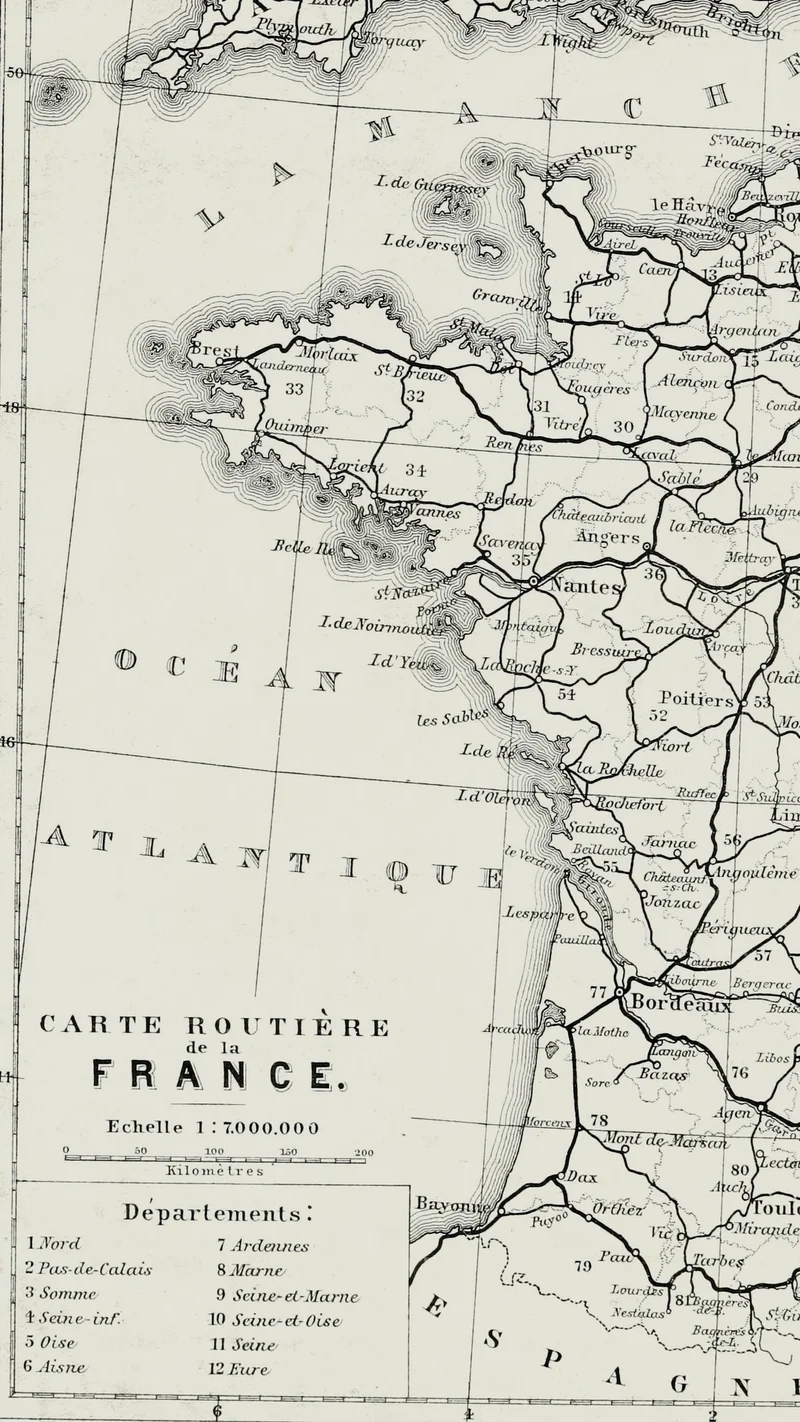
Road Map of France from Baedeker's Paris and Environs
1881
About this artwork
This is a detailed black and white engraved road map of France, published as part of a Baedeker travel handbook. The map delineates key towns, geographic features, and transit routes across the French landscape.
Did you know?
Karl Baedeker's guidebooks were essential companions for 19th-century travelers, often considered the gold standard for accuracy and reliability. This particular map exemplifies the precision that earned the company a legendary reputation, effectively helping tourists navigate the complex web of European infrastructure before the era of modern travel technologies.

On your wall. Unlock the HD download and keep this piece in your Vault — forever.
Know the artwork. Knowing its title and artist turns a beautiful image into a story worth sharing — with a museum label:
Road Map of France from Baedeker's Paris and Environs
Karl Baedeker (Firm), 1881