Map of the Bois de Meudon, Paris and Environs
1881
About this artwork
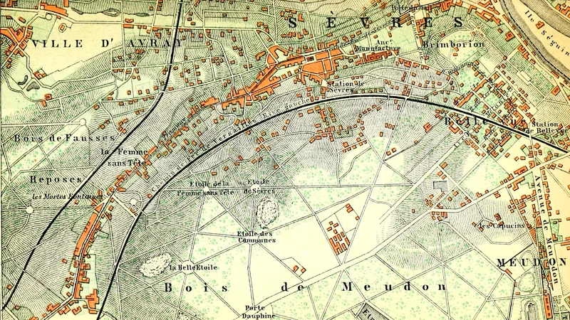
A detailed topographical map featured in a Baedeker handbook for travelers, illustrating the Bois de Meudon area near Paris. The map includes rail lines, forested regions, and local landmarks.
Did you know?
Karl Baedeker's guidebooks were renowned for their meticulous accuracy, often considered the gold standard for nineteenth-century travelers. The term 'Baedekering' even entered the lexicon as a verb for touring with one of these reliable, map-filled companions in hand. This specific map highlights the strategic and recreational importance of the Meudon forest area during the period.

On your wall. Unlock the HD download and keep this piece in your Vault — forever.
Know the artwork. Knowing its title and artist turns a beautiful image into a story worth sharing — with a museum label:
Map of the Bois de Meudon, Paris and Environs
Karl Baedeker, 1881