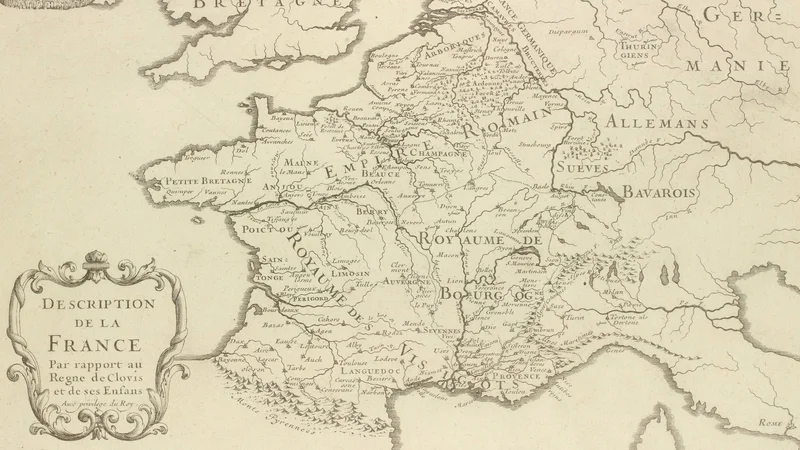
Description of France in the Reign of Clovis and his Children
1705
About this artwork
This is a detailed historical map from the 'Atlas Curieux' by Nicolas de Fer, showing the political divisions of France during the Merovingian period. It is a monochromatic copperplate engraving featuring a decorative cartouche in the bottom left corner.
Did you know?
This map was part of the 'Atlas Curieux,' a highly popular 18th-century work that aimed to make geographic knowledge accessible and engaging for a wider audience. Nicolas de Fer was an official cartographer to the French King, meaning his work served both an educational and a political purpose by visualizing the historical legitimacy of the French kingdom. The map specifically highlights the Merovingian era, showing the consolidation of power by Clovis and his successors, which was foundational to French national identity.

On your wall. Unlock the 4K download and keep this piece in your Vault — forever.
Know the artwork. Knowing its title and artist turns a beautiful image into a story worth sharing — with a museum label:
Description of France in the Reign of Clovis and his Children
Nicolas de Fer, 1705