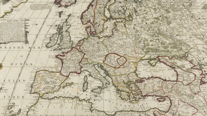
L'Europe: suivant les nouvelles observations de Mrs. de l'Academie royale des sciences
1699 Bibliothèque nationale de France
About this artwork
An 18th-century engraved map of Europe created by cartographer Nicolas de Fer, featuring decorative cartouches and detailed geographical borders.
Did you know?
This map reflects the era's scientific rigor, specifically referencing the updated observations from the French Royal Academy of Sciences. It was produced by Nicolas de Fer, who served as the official geographer to the Dauphin of France, highlighting the importance of cartography in 17th-century royal propaganda and geopolitical understanding.
On your wall. Unlock the 4K download and keep this piece in your Vault — forever.
Know the artwork. Knowing its title and artist turns a beautiful image into a story worth sharing — with a museum label:
L'Europe: suivant les nouvelles observations de Mrs. de l'Academie royale des sciences
Nicolas de Fer, 1699