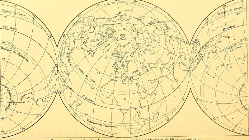
Map of the world projected onto a plane parallel to the horizon of Central Europe
1905
About this artwork
This is a map projection centered on Central Europe, illustrating the globe as a series of connected circular segments. It was published in the Bulletin de la Société géologique de France in 1905.
Did you know?
This map uses a unique gnomonic projection centered on Central Europe, which distorts the peripheral continents to maintain a specific perspective on the world from that European vantage point. It serves as a fascinating example of how early 20th-century geologists and cartographers manipulated projections to emphasize their specific region of interest for scientific discourse.

On your wall. Unlock the HD download and keep this piece in your Vault — forever.
Know the artwork. Knowing its title and artist turns a beautiful image into a story worth sharing — with a museum label:
Map of the world projected onto a plane parallel to the horizon of Central Europe
Société géologique de France, 1905