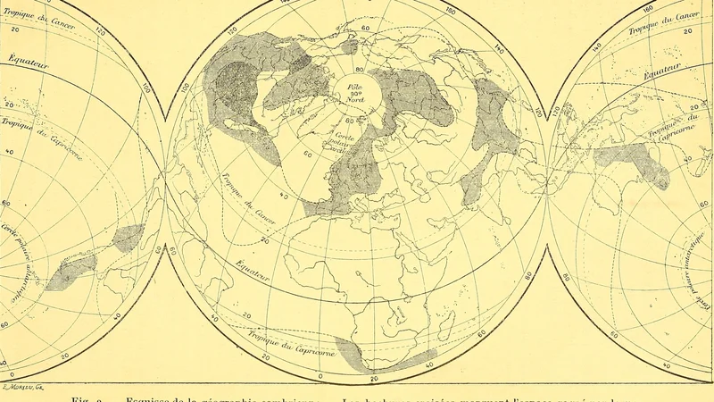
Sketch of Cambrian Geography
1905 Société géologique de France
About this artwork
A scientific map illustration from the Bulletin of the Geological Society of France depicting projected landmasses during the Cambrian period.
Did you know?
This map illustrates a 1905 scientific reconstruction of the world's geography during the Cambrian period, a time when life on Earth underwent a rapid evolutionary burst. The shaded areas represent hypothetical land distribution based on geological evidence available to scientists at the turn of the 20th century. Such maps were vital for early paleontologists to understand how continental drift and changing sea levels influenced the migration and isolation of early marine species.

On your wall. Unlock the HD download and keep this piece in your Vault — forever.
Know the artwork. Knowing its title and artist turns a beautiful image into a story worth sharing — with a museum label:
Sketch of Cambrian Geography
Société géologique de France, 1905